-GPS
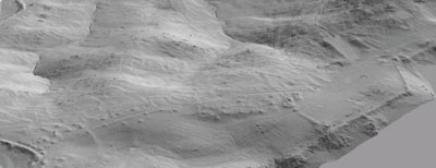
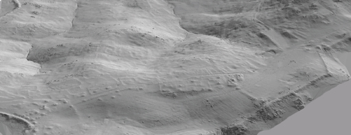
data from which 3D models were generated using ESRI GIS software (Arc
View with Arc Scene) provide useful visualisation of the terrain assisting
with analysis and interpretation of 2D geophysical survey images.
-ESRI CBS yazilimlari (Arc View ile Arc Scene) kullanilarak
GPS verilerinden 3-boyutlu modeller hazirlanmasi, 2-boyutlu jeofiziksel
yüzey arastirmasi verilerinin degerlendirme ve yorumu için
faydali topografik görüntüler üretmektedir.